With Atlantic hurricane season officially underway, NOAA’s Climate Prediction Center is forecasting another busy year. Experts put the probability of an “above-normal” storm season at 60%; the chances of a “below-normal” season at a rather discouraging 10%. The consensus, however, is that storm activity is unlikely to rival the historic level seen in 2020.
From June 1 through November 30, according to NOAA, the roll call for the class of 2021 will comprise 13 to 20 named storms (winds of >39 mph), of which 6 to 10 could become hurricanes (74 – 110 mph), including 3 to 5 major hurricanes (the CAT 3, 4 or 5 events, >111 mph winds).
Any suggestion that 2021 should be less turbulent than last year is little comfort given that the 2020 season registered a record 30 named storms (14 hurricanes, 6 of which were major in strength). Notwithstanding the devastating toll on life in general, best estimates suggest that the combined economic toll of the 2020 hurricane season was somewhere north of $60 billion.
This is not the moment for complacency—history has repeatedly shown that it only takes one powerful storm to devastate a community—and public officials up and down the eastern seaboard and in and around the Gulf of Mexico are issuing the necessary warnings and encouraging residents to prepare for severe weather events.
Uncrewed Technology
Meteorological predictions of this nature rely heavily on an essential ecosystem of innovative programs and uncrewed technologies engineered to harvest and process critical environmental data. So critical, in fact, that NOAA recently made several updates to products and services designed to model tropical cyclones, including upgrades to the Global Forecast System (GFS) and the probabilistic storm surge model (P-Surge). Feeding these intensity models is NOAA’s ocean-deployed fleet of ALAMO floats, saildrones, hurricane gliders, and drifters. New to the lineup for 2021, aerial drones will also be launched from NOAA Hurricane Hunter aircraft to report on storm development in real-time.
The advent of uncrewed technology is completely redefining the role and capabilities of the present-day hydrographer and, within this context, the work we can do to assess the cumulative impacts of extreme weather patterns on the planet’s shorelines and their native ecosystems.
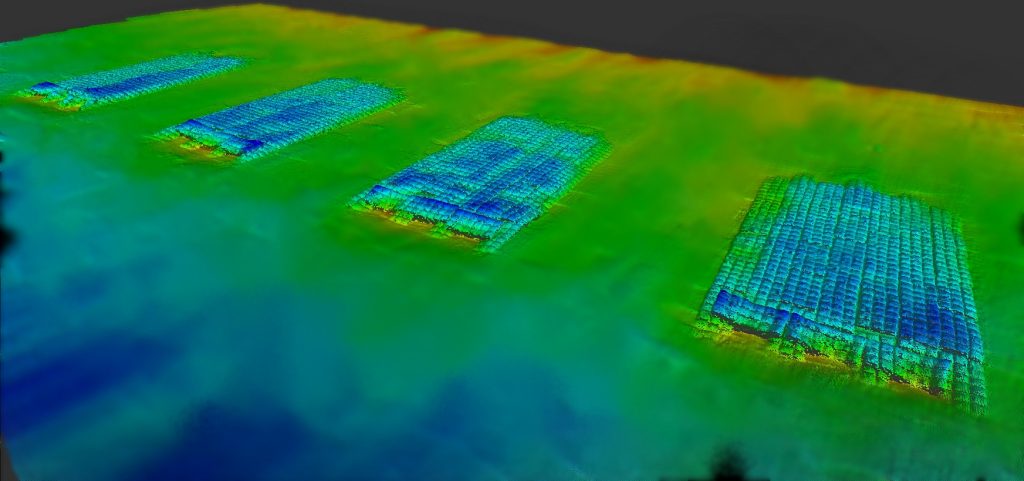
This is an important part of what we do at M&E. We work with public and private entities to help monitor the hydrographic and topographic variables up and down the Florida coast year-round. We do this through wading profiles with hardbottom mapping, onshore/offshore beach profiling pre- and post-event, multibeam surveys of artificial reef structures, and the inspection of dune conditions. These techniques afford a unique perspective on the need for any restorative action, such as beach renourishment, the creation of artificial reefs, etc. before or after a period of intense storm activity.
Like NOAA, at M&E we use cutting-edge instrumentation, such as multibeam echosounders, side scan sonar, and LiDAR to harvest the highest quality data possible. The way we deploy such sensors, however, is changing due to the transformative capabilities of crewless assets. As control systems continue to advance, sensor suites can be housed by increasingly intelligent platforms, such as autonomous surface vehicles (ASVs), ideally suited to running repetitive survey lines and standardized sampling.
Autonomous Surface Vehicles (ASVs)
The incorporation of ASV technology signals a new era of efficiency and accuracy; not only are operators able to minimalize the need for topside support (significantly reducing operational overheads and vessel set-up time) but they can also maximize data accuracy by eliminating the margin of human error (and stresses) associated with manual control.
Another clear benefit is the speed by which data can be processed and analyzed, with real-time interpretation from a shore-based command or small workboat. When trying to assess the impacts of specific weather systems on a shoreline, in a marine environment that by nature is in constant flux, rapid and reliable findings are needed to inform data-led decision making.
One of our preferred models of ASV is the SR-Surveyor M1.8, which supports an EdgeTech 2205 swath bathymetry and side scan sonar and Velodyne LiDAR for mapping features above the water surface. At only 1.8 meters in length, the highly integrated system delivers synchronized data capture of two frequencies of side scan, motion tolerant side scan, wide swath bathymetry, backscatter, LiDAR point cloud data, and discharge data. Highly portable and plug-and-play ready, compact ASVs like this have proven instrumental to coastal survey services pre-, during, and post-hurricane season.
Learn more about M&E’s use of uncrewed technology for the capture of robust and reliable coastal survey data. You can also review how our surveys help frame our clients’ coastal restoration and protection plans.

