Beach erosion is a common challenge up and down Florida’s coastline. Shifting currents, tides, and structural engineering tend to accentuate the impacts of beach erosion and trigger problems. Even without hurricane-force winds and waves, shorelines around the Florida coast are experiencing erosion and washout. To prevent and mitigate the impacts of sea level rise, storm surge, and heavy rain, researchers and environmental planners have employed tactics like living shorelines, oyster reef restoration, and the deployment of artificial reefs.
Artificial reefs made with reef balls are a common storm surge and erosion mitigation tactic used around the world. Many studies and restoration projects in the Gulf of Mexico have and are currently testing the best substrate, shape, and placement for artificial reef balls. The artificial reefs have been claimed to increase habitat for fish and benthic marine species and decrease wave action along the coast. While more common in the Gulf of Mexico, they are found in smaller numbers along the East Coast of the United States in the Atlantic. While knowledge from other locations with similar erosional and habitat issues, like on coastlines along the Gulf of Mexico, can serve as baseline knowledge, there are not many direct comparable research projects in the Atlantic.
Testing Success on the Atlantic Coastline
Like many other cases, the Hutchinson Island Power Plant, located beachside on Hutchinson Island, Florida, was impacted by erosion from Hurricane Frances in 2004. The severe erosion stretched along the coast in front of the power plant, resulting in the loss of around 70 feet of beach. With this significant barrier of beach sediment removed, ocean waves were able to reach within 20 feet of the power plant’s water discharge canal.
The reef balls were deployed off the beach east of the power plant to decrease beach erosion and provide habitat.
In an effort to mitigate erosion conditions from storm events in the future, a pilot project to create an artificial reef was launched. Outside of the direct impacts on the local region, the pilot project would also produce data for other coastal practitioners to consider artificial reef balls as a solution along the Atlantic coast.
In 2020, an experimental breakwater made up of 580 concrete reef balls, all four feet in height, was deployed. Unlike traditionally engineered breakwaters that can negatively impact aquatic species and produce secondary erosion channels, the reef mats were made to replicate the substrate of a natural reef. Designed to serve two specific purposes, to both decrease wave energy and therefore reduce beach erosion and to create a healthy coastal reef habitat, this artificial reef was installed with nature in mind.
Reef balls are made to safeguard against storm energy—like the Cat 3 cyclonic forces imparted by Hurricane Frances—while also allowing endangered native species like sea turtles access to a nesting beach. The 3D structure created by the reef balls are hot spots for microorganism settlement, fish aggregation, corals, and other aquatic species. Additionally, since sediment can travel through the series of concrete reef balls, there is hope for sediment accumulation on the beach face.
Morgan & Eklund (M&E), contracted by Florida Power and Light, was tasked with completing a hardbottom survey pre- and post-project completion. The hardbottom survey provided accurate, validated data to guide engineers and scientists to complete the reef mat deployment safely and efficiently.
The Right Team for the Job
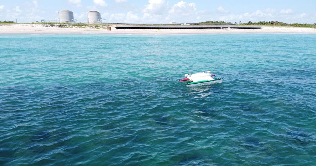
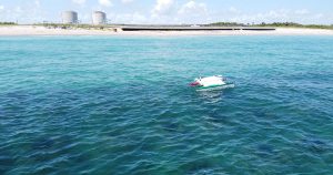
When performing an accurate survey of this nature, the field teams at M&E rely on a number of key technologies—including side scan sonar, LiDAR, RTK GPS, and multibeam echo sounders—but instrumental to this particular project was the deployment of M&E’s autonomous survey vehicle (ASV). Our current ASV of choice is a SeaRobotics SR-Surveyor M1.8. With its catamaran hull design, the SR-Surveyor M1.8 is a unique autonomous platform equipped with a multi-sensor package that includes an EdgeTech 2205 multibeam echosounder, a 1,600 kHz and 540 kHz dual-beam side-scan sonar, an AML Oceanographic SV sound velocity sensor, and a Velodyne LIDAR for mapping features above the water surface.
The autonomous survey vessel (ASV), with its increased maneuverability, extends M&E’s traditional surveying capabilities into hard-to-access locations.
The ASV’s capacity to capture such a diverse range of data sets alongside its portability and ease of deployment deliver a series of game-changing benefits to M&E operators, and so subsequently, our customers, including cost-effective operations, precision and accuracy, safety, and speedy, efficient data processing and interpretation.
For this project in particular, the needed operating depth for a traditional surveying vessel was impeded by the reef balls. The ASV was able to go where the survey vessel could not and maneuver efficiently and accurately to produce the needed data set for the client.
Following the deployment in July 2020, M&E will complete periodic monitoring surveys to help decipher erosional changes along the beach as well as bathymetry changes in and surrounding the reef mats. In addition to M&E’s monitoring, InWater Research Group provides environmental monitoring of the reef area, more specifically as it pertains to impacts on sea turtles, to assess for habitat impacts and bioproductivity.
Overall, research pilot projects like this one help provide data and a foundation for applied marine science practitioners to employ mitigative tactics to solve erosion and habitat problems. To dive into M&E’s technology-driven bathymetric and topographic survey services for marine research, visit: https://morganeklund.com/services/autonomous-remote-surveys
