Florida inlets are busy, multiuse areas often troubled with complex and abstruse issues. Florida beaches and inlet regions have been developed and engineered to support the Blue Economy and tourism revenue but continue to battle inlet’s number one issue—beach erosion and longshore drift.
The altering of inlets’ natural structure has heavily impacted how sediment moves south along Florida beaches, in and out of the inlets, and often leads to isolated heavy erosion along the southern extent of inlets, as is the case for Fort Pierce Inlet.
Ft. Pierce Inlet Management Plan
The need for managing Florida navigational inlets for recreational, commercial, and environmental purposes has been acknowledged by Florida Legislature. Traditional practices for managing inlet erosion and sediment movements include dredging and beach renourishment. These practices strive to balance the coastal sediment budget and environmental impacts and the fiscal budget associated with Florida’s beaches and inlets.
Historically, Ft. Pierce Inlet has had over 3,452,500 cubic yards of maintenance dredging completed—that equates to an $86 million payout on the low end—the majority of which is paid by the federal government. The Florida Department of Environmental Protection (FDEP) has adopted the Ft. Pierce Inlet Management Plan to better understand the issues surrounding the inlet and provide guidance on how to best mitigate and maintain the marine environment for continued commercial, recreational, and environmental uses.
Supporting Bio-Resilience
In 2020, an updated inlet management study was completed by Olsen Associates, Inc. to develop a contemporary sediment budget and provide a new comprehensive seabed and shoreline survey of the overall inlet system. After completion of the survey and analysis, FDEP developed and approved an updated inlet management plan in 2022 that included some of the original strategies and some new recommendations for the inlet, including construction and monitoring of a pilot sediment trap project to collect sand within the inlet throat for subsequent bypass-dredging to the south beaches.
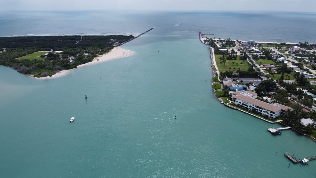
An oblique view of the Ft. Pierce Inlet with multibeam echosounder data of artificial reefs post-construction. (Image credit: M&E)
As reported in the management plan, the equivalent of 10,000 cubic yards per year of sediment are periodically dredged for maintenance, and another 60,000+ cubic yards of sediment are diverted into the inlet system, with overall resulting erosion along the beach within about 1.3 miles south of the inlet. The “Phase 1 sediment trap”, constructed in 2022, was built in conjunction with an artificial mitigation reef. The basin, which was strategically placed to maximize the capture of eroded sediment from the north side of the inlet, has the capacity to catch 60,000 cubic yards of sediment. The sediment trap was designed and permitted by Taylor Engineering Inc, and its post-construction performance monitoring is being conducted by Olsen Associates, Inc. Actively engineering this mitigation area allows for increased entrapment of sediment over time, providing a series of benefits:
- The sediment basin can be used as a unique source of bypass material for southside inlet renourishment projects,
- The amount of maintenance dredging completed each year can be decreased due to the geographic isolation of eroded sediment—some portion of the sand otherwise lost into the inlet system can be recovered for placement to the south beaches,
- Environment, navigational, and cost impacts are decreased with decreased dredging activity.
M&E has a long-standing relationship with both Taylor Engineering and Olsen Associates and has previous survey experience at Ft. Pierce Inlet. Our most recent series of surveys have been collected under subcontracts by both firms, each of which is a consultant to St. Lucie County.
M&E has performed a variety of hydrographic and geophysical surveys in the inlet and on the neighboring beaches. Multibeam and single beam echosounder surveys have been collected for quantitative measures before and after construction activities, specifically for the mitigation reef and sediment trap phases of the Management Plan. Additional geophysical surveys, such as towed magnetometer and beach profiles, have been collected as well. M&E continues to provide Olsen Associates survey support to capture field conditions as they change to validate the engineering hydrodynamic models for the Ft. Pierce Inlet Management Plan.
Multidisciplinary Survey Services Since 1997
Morgan & Eklund (M&E), a hydrographic and geophysical survey services company, has been providing survey and mapping services to the public and private sectors for over 36 years with a focus on the East coast of Florida, including to St. Lucie County since 1997.
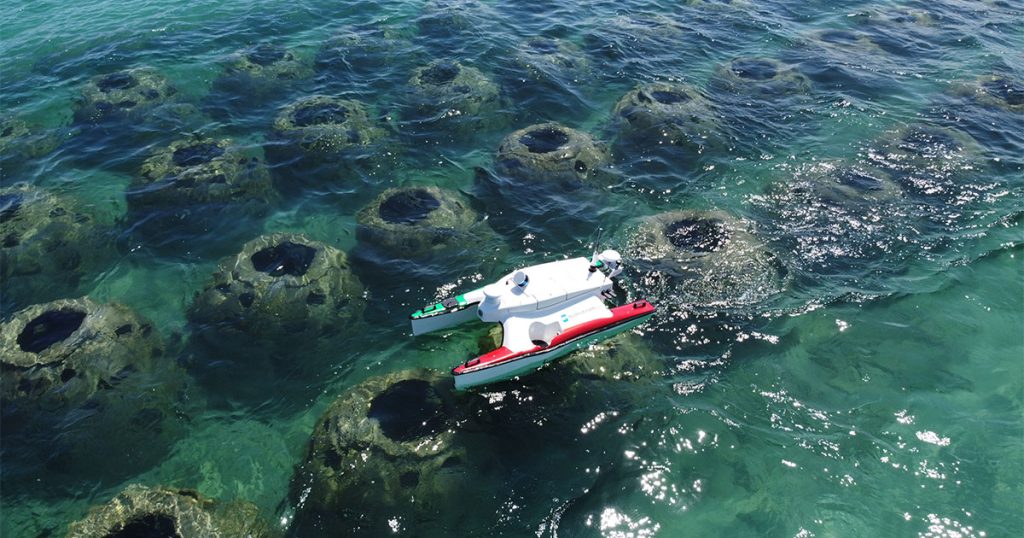
A six-month post-construction hydrographic and topographic monitoring survey. (Image credit: M&E)
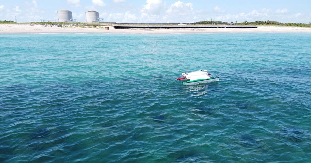
Experienced in offering services for beach restoration, hydrographic survey, water management, and coastal erosion monitoring projects, M&E is equipped with a professional and knowledgeable team. Survey operations can be performed on any of M&E’s various assets, such as our 25’ Parker Survey Boat or, more uniquely, our autonomous survey vessel (ASV). Additionally, M&E also has a unique and top-of-the-line toolbox at its disposal, including multibeam echo sounders, side scan sonar, LiDAR, and RTK GPS.
To find out more about M&E’s hydrographic and topographic survey services for managing projects like this one, visit: https://morganeklund.com/.
This feature appeared in Environment, Coastal, and Offshore (ECO) Magazine’s 2023 Summer edition, to read more about Bio-Resilient Coasts access the magazine here.
