In August of 2023, Hurricane Idalia landed as a Category 3 hurricane near Keaton Beach, Florida. Characterized by winds upwards of 125 mph and a storm surge of 7–12 feet, the major storm event left behind significant damage in its wake. Coastal beach and dune erosion, flooding, and structural damage to buildings were some of the most notable impacts.
Post-Hurricane Assessment
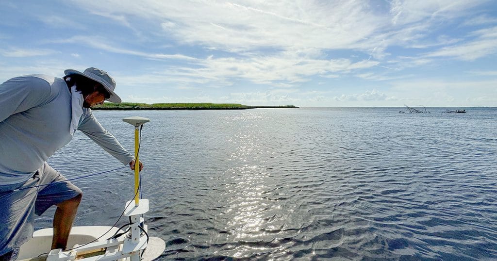
As a result of Hurricane Idalia, the Florida Fish and Wildlife Conservation Commission (FWC) needed to assess any subsequent shifts or possible impediments to the channels and Aids to Navigation (ATON) located along the Suwannee River. The new channel limits of the Suwannee River caused by the hurricane’s storm surge were unknown to FWC. To fill knowledge gaps and provide a baseline for which FWC could make data-led decisions, a bathymetric survey was required.
Contracted by Atkins—a civil engineering firm—and FWC, Morgan & Eklund (M&E) performed a bathymetric survey of the marked entrance channels to the Suwannee River, which included the following scope of work: verifying horizontal and vertical control measurements; locating current channel markers; and performing a single beam survey on 100’ cross-sections along previous survey channels. Additionally, inside confined areas, M&E surveyed shore to shore, and when outside in open water, M&E surveyed 250’ on each side of the historic centerline. Leveraged for this contract was M&E’s newly acquired survey vessel, a 21’ Carolina Skiff outfitted to perform jobs in rivers, larger canals, inside inlets, and nearshore locations.
Post survey, FWC is armed with a robust data set, including bathymetric contour maps and cross-sections, to be better prepared to make decisions founded on defensible data.
Multidisciplinary Survey Since 1985
M&E, a hydrographic and geophysical survey services company, has been providing survey and mapping services to the public and private sectors with a focus on the East Coast of Florida.
Experienced in offering services for beach restoration, hydrographic survey, water management, and coastal erosion monitoring projects, M&E is staffed with a leading team of experts in multidisciplinary coastal surveys up and down the shorelines of Florida. Survey operations can be performed on any of M&E’s various assets, such as our 25’ Parker Survey Boat, 21’ Carolina Survey Skiff, or our fleet of autonomous survey vessels (ASVs). Additionally, M&E also has a growing toolbox of the latest marine technologies at its disposal, including multibeam echo sounders, side scan sonar, and RTK GPS.
This feature appeared in environment coastal & offshore (eco) magazine’s 2025 spring edition The Blue Economy, to read more access the magazine here.
