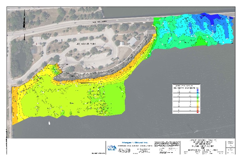
Morgan & Eklund, Inc. (M&E) were subcontracted by Infrastructure Solution Services to conduct a bathymetric survey and topographic survey of the area surrounding the pier and the general dredging area at Lee Wenner Park.
As a subcontractor to Infrastructure Solution Services, M&E performed an inshore single-beam bathymetric and upland topographic survey of structures, boat ramps, rip rap, seawalls, and waters surrounding Lee Wenner Park. M&E worked with the client and utilized their provided horizontal and vertical control for the project area.
The purpose of the survey was to detect and map any submerged or exposed obstructions, and any potential dredging hazards, and to establish a pre-dredge/pre-construction surface. The hydrographic survey was collected in a grid pattern of no less than 25’ spacing. The upland portion, just up to the existing toe of the slope or sea wall/structure of the survey was tied into the bathymetric portion for a seamless topobathy.
The survey was completed in compliance with USACE EM 1110-2-1003 Hydrographic Surveying manual and meets or exceeds the Standards of Practice (Standards) set forth by the Florida Board of Professional Surveyors and Mappers in Chapter 5J-17, Florida Administrative Code, pursuant to Section 472.027, Florida Statutes. M&E collected the single beam elevation data using our state-of-the-art bathymetric charting system consisting of a 16’ G3 Survey Boat, Real-time Kinematic (RTK) Positioning System, Digital System Fathometer, Hypack Navigation Software, and Heave, Pitch and Roll Compensator.

