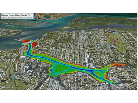
Under the terms of our professional services agreement with Martin County, Morgan & Eklund, Inc. (M&E) performed a single beam bathymetric survey of the Manatee Pocket Mooring Fields.
The scope of work included surveying the entire marked channel and two areas inside existing mooring fields on 100’ stations. In all, 14 line miles were surveyed across depths ranging from -1 to -24 feet at the deepest points. Deliverables were plan and profile in AutoCAD and .pdf format and an XYZ file.
We collected the data using our 16’ survey boat, Trimble MPS500 RTK GNSS, Odom Digital Fathometer, and Hypack Navigation Software.
Water surface elevations were measured in real-time by RTK GNSS and verified to a tide staff elevated from a Florida Department of Environmental Protections (FDEP) Range Monument using differential leveling.
Quality control procedures for the single beam profiles included closed-loop level runs and verifying the correlation between real-time survey vessel tide readings and those read by the tide staff. Calibration of the echosounder was performed by using bar checks and sound velocity profiles.

